Watch out for falling rocks!

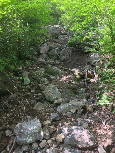
Erosion has been severe at the very top of the steep slope in the woodland (directly below the “Numanohara: 2 km” sign), and therefore unstable rocks may be situated on the trail in some places.
Thus, when walking in a group or when others are present, ascend and descend carefully so that rocks do not fall on climbers below.
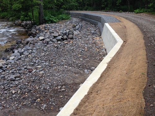
Photo: The woodland in the lower area of the Numanohara trail Jul. 2

Onuma campsite

The water has receded at Onuma campsite, making the campsite suitable for the pitching of tents.
However, climbers should be aware that it can become flooded and unusable after heavy rains, so it is best to check weather reports before climbing.
Photo: Onuma campsite Jul. 2

Snow remains in the lower area of Goshikigahara.

There is a steep climb from the Goshiki watering place. The climb up the narrow and slippery trail gouged out of a ditch arrives at a snowfield of about 90 meters. The lower section of about 15 meters is fairly steep, and thus care is required when going up and down. Cutting out steps and use of crampons may be necessary depending on the condition of the snow’s surface.
After this snowfield comes a continuing string of snowfields measuring 130, 220, 80, 80, 50, and 200 meters. Because traversing them will require checking position on topographic maps and a GPS device and setting direction with a compass, those who lack confidence in their climbing skills should refrain from climbing here for the time being.
Photos: A snowfield in the upper area of the Goshiki watering place (left) and snowfield in the lower area of Goshikigahara (right) Jul. 2

Sounkyo Honyru Rindo

The Sounkyo Honyru Rindo forest road to Numanohara, which had been closed due to damage caused by torrential rains in August 2010, was reopened on June 27. Major repairs were made here and there on the road and have made it easier to travel. We would like to thank the Forest Management Office for its hard work. The gate at the entrance to the forest road is locked. If you plan to use the Numanohara trail, please first get the key number by contacting the Kamikawa Chubu Forest Management Office.
Photo: The Sounkyo Honryu Rindo forest road Jul. 2

Snowy gorges on the Mt. Aka course

The mountain opened to traverse climbing yesterday, and many climbers began climbing from Mt.
Aka. Partly as a result, it was fairly easy to walk on the snowy gorges this morning. However, even if walking is easier, there are still many snowy gorges remaining on the Mt. Aka course, and the trail is only rarely exposed. Consequently, climbers are asked to be careful when walking on snowy gorges during dense fog and when descending.

Snowy gorge information:
Daiichi Kaen: The trail is exposed about 12 meters before the snow depth pole and sign and about 15 meters below the lookout.
Daini Kaen: The trail is completely covered with snow. There are no ropes or markings.
Daisan Sekkei: The trail is completely covered with snow. There are no ropes or markings.
Daiyon Sekkei: The trail is exposed for only about 20 meters in the upper area.
Photos: Daiichi Kaen (left) and Daisan Sekkei (right) Jul. 1