The best time for viewing Dryas octopetala var. asiatica

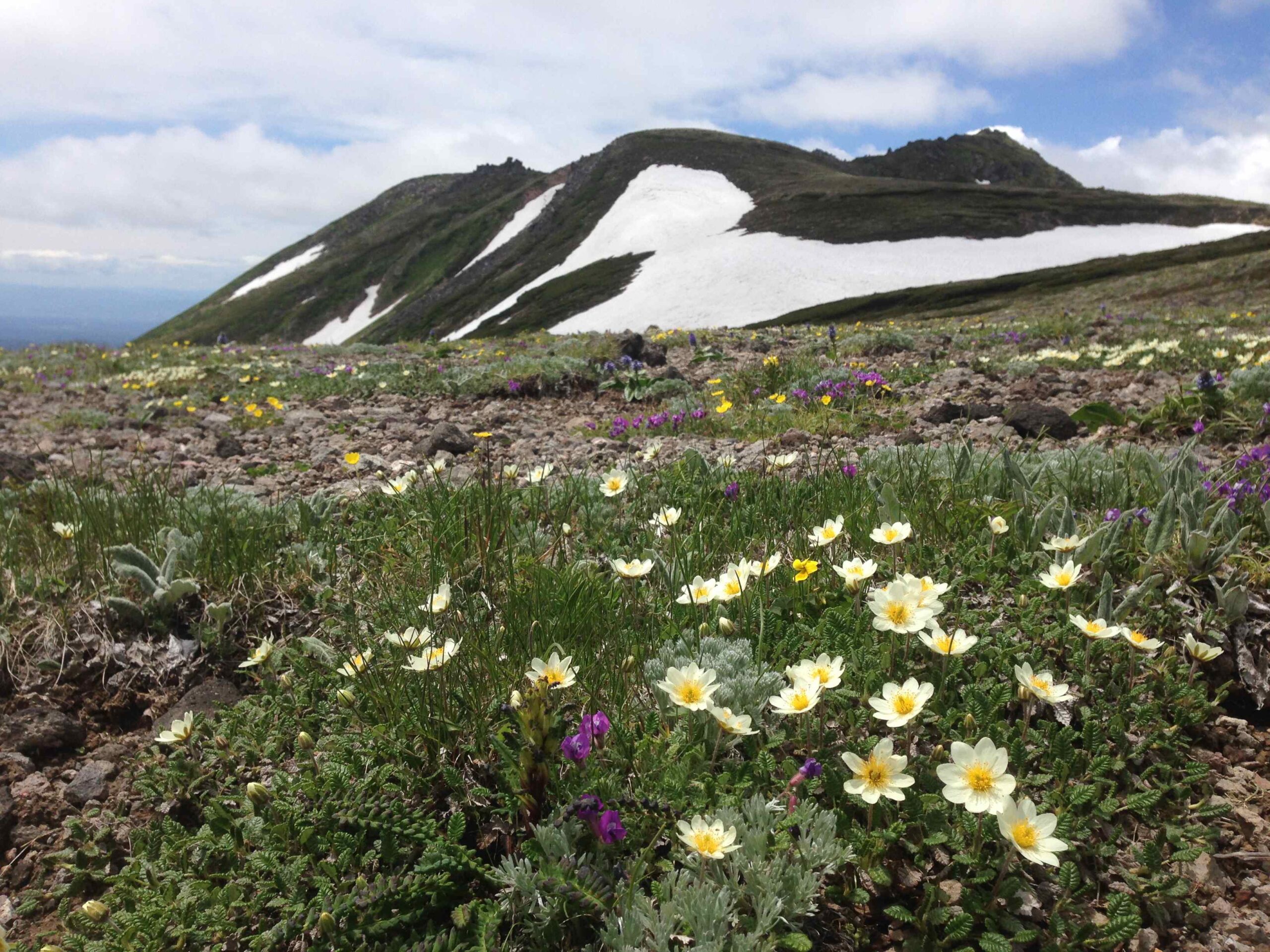
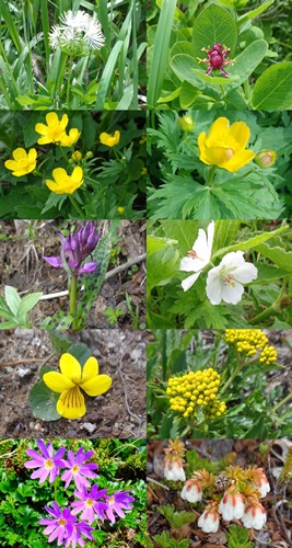
The Dryas octopetala var. asiatica are blooming all at once between the Itagaki junction and Koizumidaira. There are still many buds on the plants, so the number of flowers should increase even more in the days ahead. Of course what happens will depend on the weather, but the best viewing time should begin this weekend and continue through next week.
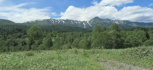
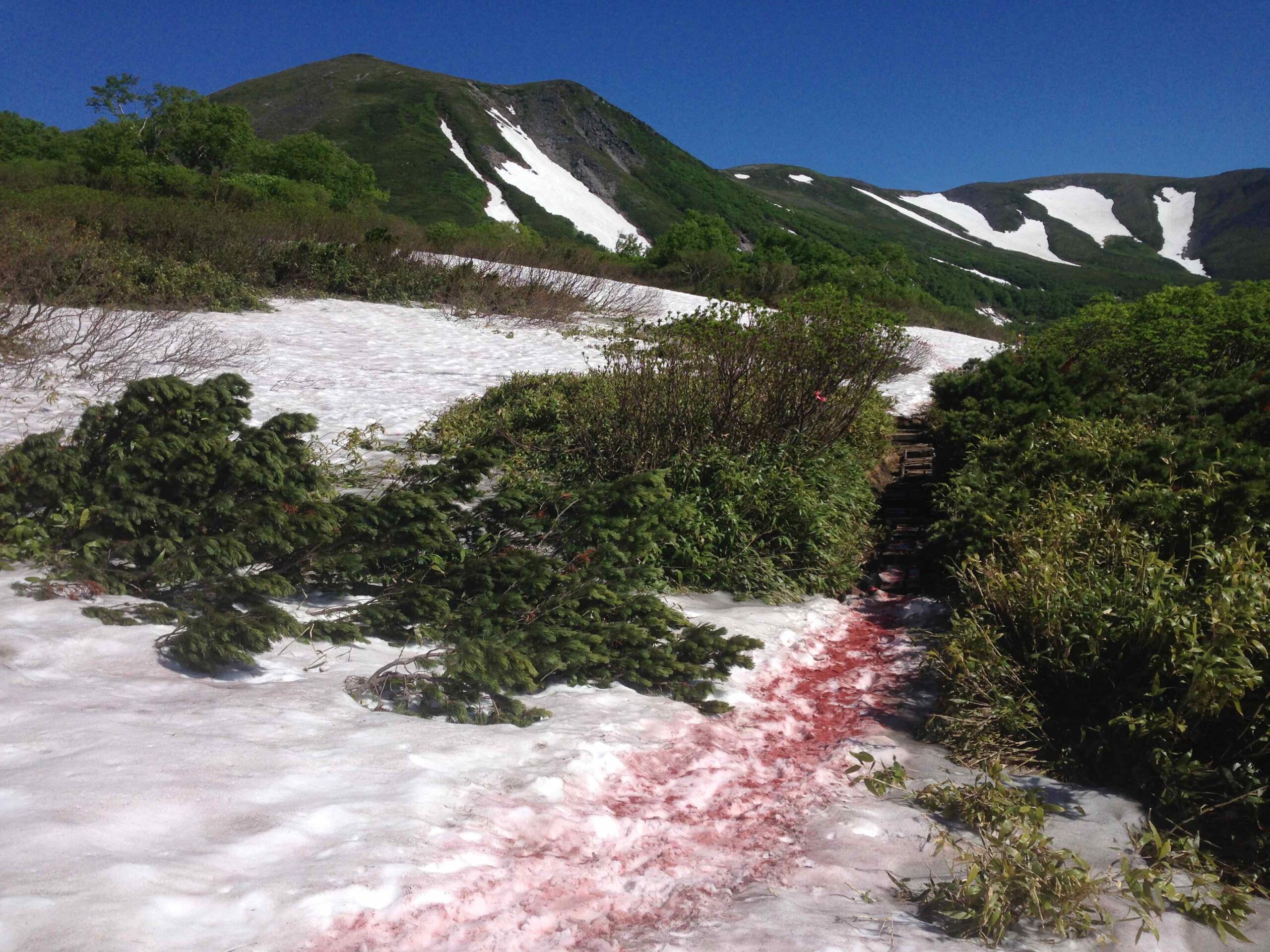
Photo: Koizumidaira Jun. 29

Snow remains on the middle slopes of Mt. Midori.

Although the snow on the middle slopes of Mt. Midori is melting more quickly than last year, the areas around Daiichi Hanabatake and Daini Hanabatake are still largely snow fields. Thickets of Pinus pumila are growing here and there, particularly from Daini Hanabatake to the Eiko no Sawa rocky slope, and make it difficult to take direct shortcuts. When visibility is poor, climbers should proceed while confirming the route with a compass or GPS device. Moreover, care should be taken to avoid wandering off the route by following pink tape that was placed for use during the high snow season or mistaken footprints.
Photo: The upper area of Daini Hanabatake, Mt. Midori Jun. 29

Near Hisago-numa

The snow around Hisago-numa is melting more quickly this year than usual; however, major parts of the trails from the ridgeline down to the pond are buried in snow. When visibility is poor, the route from the north junction (Kaundaira) down to the pond requires the ability to determine the direction to the pond with a compass. As for the route from the south junction to the pond’s western side, a steep snowy gorge remains. Preparations such as the wearing of crampons may be required when descending. In either case, climbers who are unaccustomed to walking on snow should be accompanied by an experienced leader or guide.
Photos: Hisago-numa as seen from the north junction on the ridge trail (left) and the steep snowy gorge below the south junction (right) Jun. 29

A Visitor Center course

Today the Visitor Center held a course on “Springtime Climbing: Yusendai.” The course was fully booked.
Yusendai is on a clear plateau located upstream of Ginga-no-Taki Fall. It is situated at an elevation of 950 meters.
Traveling about 3.5 km along the Ginga forest road (a service road linked with the Ginsendai route) will bring one to the Yusendai lookout. From here, views of Mt. Eboshidake, Mt. Kurodake, Mt. Ryoundake, and Mt. Kamikawadake can be enjoyed.
The course included explanations of the Ginga-no-Taki source, the origin of the name “Ginsendai,” and the role of the Ginga forest road; a description of how the dam for Lake Kodaisetsu is located near Yusendai on the left bank of the Ishikari River; and a lecture on the Larix gmelinii var.
japonica that were planted following the “Toya-maru Typhoon.”
Photo: The Daisetsuzan peaks as seen from the lookout Jun. 29

The flowers of Mt. Kurodake

New flowers have begun blooming since the last report.
Flowers are blooming all over the place near the 9th Station and above.
You might find it fun to bring a plant guide and try to remember their names as you walk.
Photo: Newly blooming flowers Jun. 28