Today the Visitor Center held a course on “Springtime Climbing: Yusendai.” The course was fully booked.
Yusendai is on a clear plateau located upstream of Ginga-no-Taki Fall. It is situated at an elevation of 950 meters.
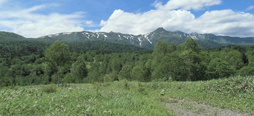
Traveling about 3.5 km along the Ginga forest road (a service road linked with the Ginsendai route) will bring one to the Yusendai lookout. From here, views of Mt. Eboshidake, Mt. Kurodake, Mt. Ryoundake, and Mt. Kamikawadake can be enjoyed.
The course included explanations of the Ginga-no-Taki source, the origin of the name “Ginsendai,” and the role of the Ginga forest road; a description of how the dam for Lake Kodaisetsu is located near Yusendai on the left bank of the Ishikari River; and a lecture on the Larix gmelinii var.
japonica that were planted following the “Toya-maru Typhoon.”
Photo: The Daisetsuzan peaks as seen from the lookout Jun. 29
